
In this guide Show sections
General guidance, not a professional assessment. Confirm site-specific advice and current requirements before work.
Planning tree work in Bedford or nearby?
Start with the postcode, the work you have in mind and any access considerations.
Prepare your enquiryNo obligation. A site assessment may be needed to confirm the work and price.
Before you arrange the work
Start with the full postcode and property position. Use the official council finder, then check that authority’s current planning resources. Do not infer tree protection from a village’s appearance, age or proximity to Bedford.
Read the map and the record
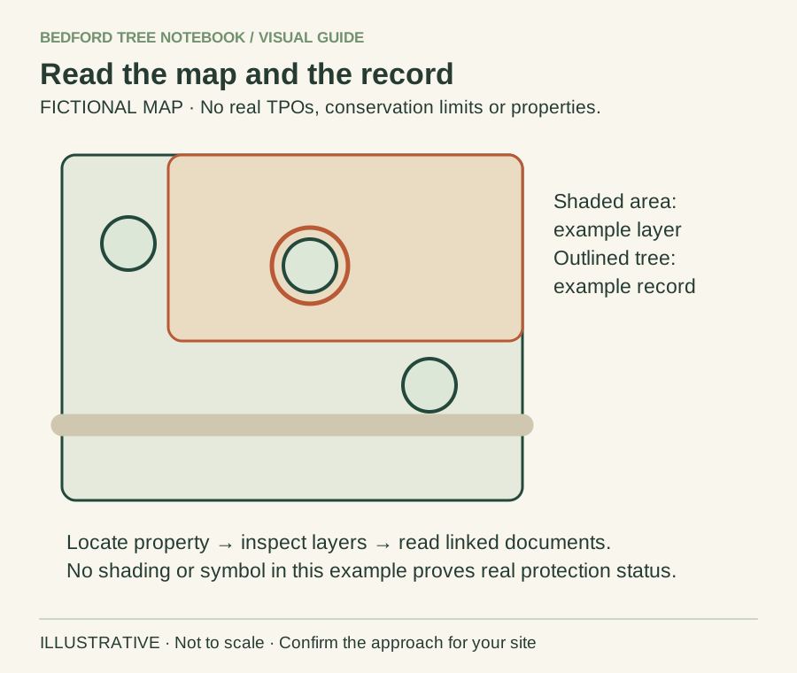
- Find the actual property on the official council map.
- Inspect relevant layers and open the linked order or document.
- Ask the council where the record or boundary is unclear.
Background sources: Bedford Borough Council guidance
Confirm the authority first
Bedford Borough and Central Bedfordshire have separate records and enquiry routes. An agent’s old brochure or a neighbour’s experience may relate to a different authority or property. Our council-boundary guide explains the practical starting point.
For a rural plot, give the house name, postcode and a clear plan of the tree position. If an entrance lies on another lane, explain that too. A photograph of a tree without a location can be difficult to match to a map.
Check the tree and its surroundings
Look for the relevant Tree Preservation Order and conservation-area information. A protected group or area may require more interpretation than a single point on a map. Save the reference and ask the council to clarify where the online record leaves doubt.
Use Bedford’s tree-protection maps for the Borough workflow. Check planning conditions separately, especially on recently developed or converted properties. A map showing no obvious symbol does not answer every planning question.
Include access and ownership in the brief
An access route through a field, shared drive or neighbouring garden needs its own agreement. Establish who can authorise work and access; do not assume a landowner’s tree consent also grants permission to use another person’s land.
Our rural-property enquiry guide helps you describe gates, surfaces and routes without trying to choose machinery yourself. Confirm that a contractor actually covers the postcode before arranging a visit.
Locate the tree separately from the postal address
A rural house name can identify a property without identifying a particular tree. Prepare a simple sketch showing the house, road, entrance and tree position. Where a plot has several parcels or a long boundary, include enough context to distinguish the tree from others near the same postcode. Use photographs taken from a safe place and label the direction of view in your working notes.
A location pin or sketch supports an enquiry; it is not a substitute for checking ownership or the legal extent of a designation. Tell the council where you are uncertain rather than drawing a confident boundary you cannot verify. The rural-property enquiry guide covers entrance and access details that can accompany the planning question. Keep copies of the information you supplied so that a response can be checked against the tree actually described, particularly if a neighbouring property has a similar house name.
Avoid treating a village as one planning unit
Two properties in the same village can have different planning histories, tree designations and ownership arrangements. A neighbour’s previous permission is useful background only when you understand what it concerned; it does not establish the position for your tree. Likewise, a conservation-area boundary may need closer inspection than a general village description provides.
Ask a precise question about the actual plot and proposed operation. If you are checking several trees, number them consistently on the sketch and photographs rather than relying on species names alone. A group of trees can be difficult to match to a photograph from the road, especially outside the leafy season. Our official mapping guide explains why records and map views should be read together. The purpose is to resolve uncertainty before work, not to collect a screenshot that appears reassuring while leaving the site or designation unclear.
A hypothetical council-boundary enquiry
Imagine a homeowner searches for a village by name and reaches a useful tree-information page. Before making an application, they check the property’s authority using the full postcode and discover that the page belongs to a different council. The garden has not changed, but the correct enquiry route has.
The homeowner can now use the appropriate official records and send a location sketch that identifies the tree. They should not assume the first map’s lack of a symbol answers the protection question. This example illustrates the value of checking the authority early; it is not a claim that a named village falls under a particular council. Avoid adding a local boundary claim to your enquiry unless it has been verified for the property. If the plot or tree appears close to an authority boundary, explain the uncertainty and ask which team should deal with it before commissioning paid advice or supporting documents.
Keep agricultural access and garden work distinct
A village property may have a garden entrance, farm access and a public path close together. Describe each route accurately. Permission to use one entrance does not automatically authorise machinery over every adjoining piece of land. Tell the contractor which routes you control and where another person’s agreement or an authority enquiry is still needed.
If the proposal extends beyond a domestic garden into woodland or a larger landholding, say so. The business may need to establish whether different expertise or additional checks are relevant; a homeowner should not assume that the garden-work description covers every tree on an estate. Keep the tree-protection question separate from the practical question of reaching the site. Tree work beside a public footpath addresses one common overlap. This is especially useful when a visitor could mistake an open field gate for an unrestricted entrance to the working area.
What to save after making the check
Keep the council name, date, tree identifiers and the references of relevant records. Add the written response to any specific question you asked. Record an unresolved point as unresolved; do not turn the absence of a reply into an assumption that work is acceptable.
Share relevant information with the contractor before the final quotation is accepted. If a visit changes the recommended operation or identifies a different tree, revisit the check rather than applying the earlier response automatically. A useful project folder contains the location evidence, current proposal, any applicable decision and the final scope. Leave unrelated ownership disputes or personal information about neighbours out of a routine contractor enquiry unless it is necessary to explain an actual authorisation problem. This keeps the brief focused and allows the next person to see which facts have been checked, which are simply background and which still require an answer before a working date is confirmed.
Your next step
Keep the location evidence and any written council response with the final quotation. Recheck the position if the tree or proposed work changes before the appointment.
Turn the advice into a useful project brief.
Start with the postcode, the work you have in mind and any access considerations.
Prepare your enquiryNo obligation. A site assessment may be needed to confirm the work and price.
Sources & further reading
- GOV.UK: find your local council
- Bedford Borough Council: protected trees
- GOV.UK: Tree Preservation Orders and conservation areas
Sources checked 31 October 2026. How we prepare guidance.